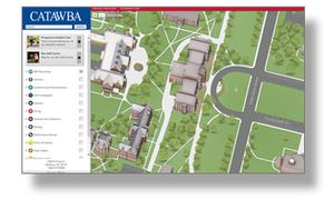
Catawba College has launched a new online interactive map as part of a new mobile-friendly, rich map-based experience for students and visitors wanting to explore the Catawba campus virtually.
Thanks to a generous gift from a longtime friend of the college, Catawba has upgraded the online and print versions of its campus map. The work, recently completed with the assistance of Boulder, Colorado-based concept3D and its Campus Bird platform, provides new, up-to-date details about Catawba's 41-building, 276-acre campus.
The new interactive campus map, available at catawba.edu/explore includes 3D models, 2D graphic overlays, custom streetview photos, videos, tours and much more. Thanks to concept3D's CampusBird interactive map manager, the college now has an easy-to-use and intuitive editing platform that allows upgrades to be made to the map as they are made to grounds and facilities on campus.
"For Catawba, this new interactive map allows us to deliver a compelling, campus experience to prospective students and their families, as well as to alumni and friends of the college, who may not be able to visit our campus in person," explained Catawba web designer Maegen Worley. "Updated Google streetview images that showcase many campus buildings are also a new feature that we are anxious to share with virtual visitors."
"Supporting clients with the solutions to effectively provide their end-users with a rich map-based experience is the ultimate goal for the CampusBird platform and our multimedia production team" said Ruston McGarr, president and chief operating officer of concept3D.
Concept3D, Inc. is a leading web, mobile and geolocation software development company. It offers professional multimedia services, custom software and web services, CampusBird interactive school maps, Atlas map management system and simuwatt energy analysis and assessment tools. Catawba has joined the growing list of higher education clients utilizing concept3D's CampusBird platform. For more details visit: www.concept3D.com.
